चित्र:Wales location map.svg

Size of this PNG preview of this SVG file: 501 × 599 पिक्सेल. अउरी रिजोल्यूशन: 201 × 240 पिक्सेल | 401 × 480 पिक्सेल | 642 × 768 पिक्सेल | 856 × 1,024 पिक्सेल | 1,713 × 2,048 पिक्सेल | 1,047 × 1,252 पिक्सेल.
ओरिजनल फाइल (एसवीजी फाइल, नॉमिनली 1,047 x 1,252 पिक्सल, फाइल के आकार: 237 KB)
सारांश
| बिबरण |
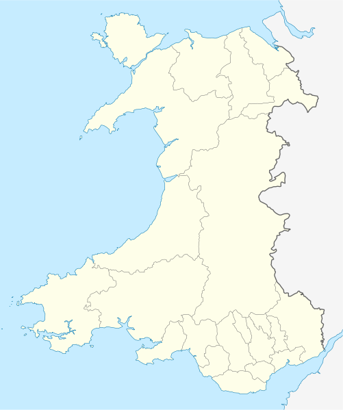
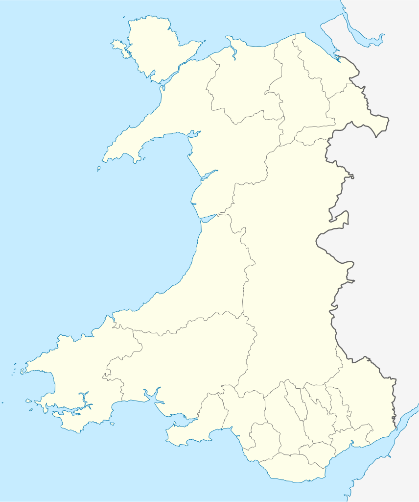
Quadratische Plattkarte, N-S-Streckung 163 %. Geographische Begrenzung der Karte:
Equirectangular projection, N/S stretching 163 %. Geographic limits of the map:
|
| तारीख | |
| स्रोत | own work, using United States National Imagery and Mapping Agency data |
| लेखक | NordNordWest |
| Other versions |
Derivative works of this file: |

|
This map has been made or improved in the German Kartenwerkstatt (Map Lab). You can propose maps to improve as well.
|
लाइसेंसिंग
I, the copyright holder of this work, hereby publish it under the following license:
ई फाइल Creative Commons Attribution-Share Alike 3.0 Unported लाइसेंस की तहत लाइसेंसी बा।
- आप फ्री बानी:
- साझा करे खातिर – रचना के नकल करे, बाँटे आ दुसरी जगह भेजे खातिर
- रीमिक्स करे खातिर – काम के अपनी हिसाब से बनावे खातिर
- नीचे दिहल कारणन की तहत:
- एट्रीब्यूशन – लाइसेंस के कड़ी दे के उचित श्रेय (क्रेडिट) दिहल जरूरी बा आ अगर कौनों बदलाव कइल गइल बा तब ओहू के बतावल जाए के चाहीं। आप ई काम कौनों उचित तरीका से क सकत बानी, बाकी ई न झलके के चाहीं की जेकरा लगे लाइसेंस बा ऊ राउर चाहे राउर काम के समर्थन करत बाटे या सही बतावत बा।
- शेयर अलाइक (share alike) – अगर आप एह सामग्री के आधार बना के कुछ रिमिक्स करत बानी, रूप बदलाव करत बानी, चाहे कुछ जोड़ के सामग्री के बढ़ावत बानी, आपके आपन योगदान ठीक एही या कंपेटिबल लाइसेंस जइसन कि ओरिजनल बाटे, के तहत होखे के चाहीं।
फाइल के इतिहास
ओ समय ई फाइल कइसन लउके ई देखे खातिर कौनों तारीख/समय पर क्लिक करीं।
| तारीख/समय | चिप्पी रूप | डाइमेंशन | प्रयोगकर्ता | टिप्पणी | |
|---|---|---|---|---|---|
| वर्तमान | 13:27, 24 जून 2009 | | 1,047 × 1,252 (237 KB) | NordNordWest | {{Information |Description= {{de|Positionskarte von Wales, Vereinigtes Königreich}} Quadratische Plattkarte, N-S-Streckung 163 %. Geographische Begrenzung der Karte: * N: 53.5° N * S: 51.3° N * W: 5.5° W * |
फाइल के उपयोग
फाइल के इस्तेमाल 3 पन्ना करत बाड़ें:
बैस्विक फाइल उपयोग
नीचे दिहल अउरी विकिसभ पर एह फाइल के इस्तेमाल हो रहल बा:
- af.wikipedia.org पर इस्तेमाल
- ar.wikipedia.org पर इस्तेमाल
- ast.wikipedia.org पर इस्तेमाल
- az.wikipedia.org पर इस्तेमाल
- ba.wikipedia.org पर इस्तेमाल
- bg.wikipedia.org पर इस्तेमाल
- bn.wikipedia.org पर इस्तेमाल
- br.wikipedia.org पर इस्तेमाल
- Dolgellau
- Bangor-is-y-coed
- Aberaeron
- Patrom:Infobox UK place
- Rhaeadr Gwy
- Llanfachraeth (Mon)
- Trefor (Mon)
- Caergybi
- Aberporth
- Beulah (Ceredigion)
- Llanfihangel-yn-Nhywyn
- Abermaw
- Llan-faes (Mon)
- Ynyslas
- Clynnog Fawr
- Ffair-rhos
- Patrom:Location map Kembre
- Bont Goch
- Gilfachreda
- Parc-llyn
- Pennant (Ceredigion)
- Brongest
- Bryngwyn (Ceredigion)
- Brynafan
- Brynhoffnant
- Coed-y-bryn
- Cwmsychbant
- Dole (Ceredigion)
- Dre-fach (Ceredigion)
- Gorsgoch
एह फाइल के अउरी बैस्विक इस्तेमाल देखीं