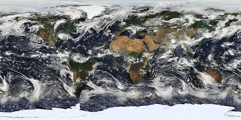
चित्र:MODIS Map.jpg

ए नमूना के साइज: 800 × 400 पिक्सेल. अउरी रिजोल्यूशन: 320 × 160 पिक्सेल | 640 × 320 पिक्सेल | 1,024 × 512 पिक्सेल | 1,280 × 640 पिक्सेल | 2,560 × 1,280 पिक्सेल | 5,400 × 2,700 पिक्सेल.
ओरिजनल फाइल (5,400 × 2,700 पिक्सेल, फाइल साइज: 11.84 MB, MIME टाइप: image/jpeg)
फाइल के इतिहास
ओ समय ई फाइल कइसन लउके ई देखे खातिर कौनों तारीख/समय पर क्लिक करीं।
| तारीख/समय | चिप्पी रूप | डाइमेंशन | प्रयोगकर्ता | टिप्पणी | |
|---|---|---|---|---|---|
| वर्तमान | 10:47, 25 फरवरी 2010 |  | 5,400 × 2,700 (11.84 MB) | Originalwana | {{Information |Description={{en|1=Image based largely on observations from the Moderate Resolution Imaging Spectroradiometer (MODIS). Small gaps in MODIS’ coverage between overpasses, as well as Antarctica, have been filled in using [[:Category:Geos |
फाइल के उपयोग
फाइल के इस्तेमाल 4 पन्ना करत बाड़ें:
बैस्विक फाइल उपयोग
नीचे दिहल अउरी विकिसभ पर एह फाइल के इस्तेमाल हो रहल बा:
- af.wikipedia.org पर इस्तेमाल
- ar.wikipedia.org पर इस्तेमाल
- ba.wikipedia.org पर इस्तेमाल
- be.wikipedia.org पर इस्तेमाल
- bn.wikipedia.org पर इस्तेमाल
- bn.wikibooks.org पर इस्तेमाल
- ca.wikipedia.org पर इस्तेमाल
- crh.wikipedia.org पर इस्तेमाल
- cs.wikipedia.org पर इस्तेमाल
- cv.wikipedia.org पर इस्तेमाल
- en.wikipedia.org पर इस्तेमाल
- Cloud cover
- Moderate Resolution Imaging Spectroradiometer
- User talk:Nauticashades
- Talk:Cloud cover
- Wikipedia:Featured pictures/Space/Looking back
- Wikipedia:Featured pictures thumbs/23
- Wikipedia:Featured picture candidates/June-2010
- Wikipedia:Featured picture candidates/MODIS Cloud Cover Map
- Wikipedia:Wikipedia Signpost/2010-06-14/Features and admins
- Portal:Climate change/Selected picture
- Portal:Climate change/Selected picture/12
- Wikipedia:Picture of the day/January 2012
- Template:POTD/2012-01-01
- Wikipedia:Main Page history/2012 January 1
- User:AvionArchon/sandbox
- Wikipedia:Wikipedia Signpost/Single/2010-06-14
- User:Darth Tacker/TWA/Earth
- User:CheChe/Spoken Script
- User:Zanygenius/TWA/Earth
- User:Zanygenius/TWA/Earth/2
- User:Google7722/TWA/Earth
- es.wikipedia.org पर इस्तेमाल
- et.wikipedia.org पर इस्तेमाल
- eu.wikipedia.org पर इस्तेमाल
- fa.wikipedia.org पर इस्तेमाल
- fa.wikibooks.org पर इस्तेमाल
- fi.wikipedia.org पर इस्तेमाल
- fr.wikipedia.org पर इस्तेमाल
- gl.wikipedia.org पर इस्तेमाल
एह फाइल के अउरी बैस्विक इस्तेमाल देखीं


