चित्र:Rio Magdalena Delta landsat.jpg
ए नमूना के साइज: 653 × 599 पिक्सेल. अउरी रिजोल्यूशन: 262 × 240 पिक्सेल | 523 × 480 पिक्सेल | 837 × 768 पिक्सेल | 1,096 × 1,006 पिक्सेल.
ओरिजनल फाइल (1,096 × 1,006 पिक्सेल, फाइल साइज: 557 KB, MIME टाइप: image/jpeg)
सारांश
| बिबरण |
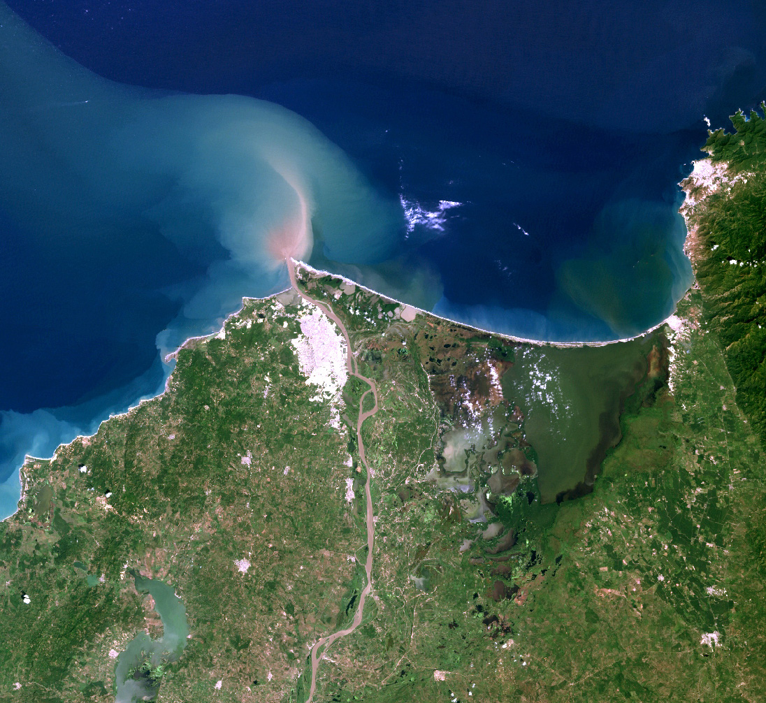
English: Landsat7 image of the Magdalena River delta. |
| तारीख | |
| स्रोत |
Source for this data set was the Global Land Cover Facility, www.landcover.org
|
| लेखक | Alexrk2 |
| परमीशन (एह फाइल के दुबारा इस्तेमाल) |
Use is free to all; effectively held by USGS & NASA; but ultimately held by US public. |
लाइसेंसिंग
| This file is in the public domain in the United States because it was solely created by NASA. NASA copyright policy states that "NASA material is not protected by copyright unless noted". (See Template:PD-USGov, NASA copyright policy page or JPL Image Use Policy.) | ||
 |
Warnings:
|
फाइल के इतिहास
ओ समय ई फाइल कइसन लउके ई देखे खातिर कौनों तारीख/समय पर क्लिक करीं।
| तारीख/समय | चिप्पी रूप | डाइमेंशन | प्रयोगकर्ता | टिप्पणी | |
|---|---|---|---|---|---|
| वर्तमान | 16:14, 9 फरवरी 2010 | | 1,096 × 1,006 (557 KB) | Alexrk2 | {{Information |Description={{en|Landsat7 image of the Magdalena River delta.}} |Source=Source for this data set was the Global Land Cover Facility, www.landcover.org * Acquisition date: 2000-11-25, Sensor: ETM+, Bands: 1,2,3 |Date=2 |
फाइल के उपयोग
फाइल के इस्तेमाल पन्ना करत बा:
बैस्विक फाइल उपयोग
नीचे दिहल अउरी विकिसभ पर एह फाइल के इस्तेमाल हो रहल बा:
- af.wikipedia.org पर इस्तेमाल
- ast.wikipedia.org पर इस्तेमाल
- avk.wikipedia.org पर इस्तेमाल
- azb.wikipedia.org पर इस्तेमाल
- de.wikipedia.org पर इस्तेमाल
- el.wikipedia.org पर इस्तेमाल
- en.wikipedia.org पर इस्तेमाल
- es.wikipedia.org पर इस्तेमाल
- fa.wikipedia.org पर इस्तेमाल
- fr.wikipedia.org पर इस्तेमाल
- id.wikipedia.org पर इस्तेमाल
- io.wikipedia.org पर इस्तेमाल
- ja.wikipedia.org पर इस्तेमाल
- ka.wikipedia.org पर इस्तेमाल
- la.wikipedia.org पर इस्तेमाल
- nl.wikipedia.org पर इस्तेमाल
- nn.wikipedia.org पर इस्तेमाल
- simple.wikipedia.org पर इस्तेमाल
- sl.wikipedia.org पर इस्तेमाल
- sw.wikipedia.org पर इस्तेमाल
- ta.wikipedia.org पर इस्तेमाल
- tr.wikipedia.org पर इस्तेमाल
- vi.wikipedia.org पर इस्तेमाल
- war.wikipedia.org पर इस्तेमाल
- xmf.wikipedia.org पर इस्तेमाल