न्यूयॉर्क सिटी
न्यूयॉर्क सिटी (अंग्रेजी: New York City) अमेरिका देस के सबसे ढेर जनसंख्या वाला शहर बाटे। साल 2020 के जनसंख्या अनुमान 8,804,190 बाटे जे 300.46 वर्ग मील (778.2 किमी2) एरिया में बितरित बाटे आ न्यूयॉर्क शहर अमेरिका के सभसे घन आबादी वाला प्रमुख शहर भी बाटे। न्यूयॉर्क राज्य के दक्खिनी छोर पर स्थित ई शहर न्यूयॉर्क महानगरीय इलाका के केंद्र हवे, शहरी क्षेत्र के हिसाब से दुनिया के सभसे बड़ महानगरीय इलाका हवे।[9] अपना महानगरीय सांख्यिकीय क्षेत्र में 20.1 मिलियन से ढेर लोग आ 2020 के हिसाब से कंबाइंड सांख्यिकीय क्षेत्र में 23.5 मिलियन लोग के साथ न्यूयॉर्क दुनिया के सभसे ढेर जनसंख्या वाला मेगासिटी सभ में से एक बा। न्यूयॉर्क शहर के दुनिया के सांस्कृतिक, बित्तीय आ मीडिया के राजधानी बतावल गइल बा आ ई वाणिज्य, मनोरंजन, रिसर्च, टेक्नालॉजी, शिक्षा, राजनीति, पर्यटन, डाइनिंग, कला, फैशन आ खेल सभ पर काफी परभाव डाले ला। ई दुनिया के सभसे ढेर फोटो खीचल गइल (मोस्ट फोटोग्राफ्ड) वाला शहर हवे।[10] संयुक्त राष्ट्र के मुख्यालय के सीट न्यूयार्क अंतर्राष्ट्रीय कूटनीति के एगो महत्वपूर्ण केंद्र हवे[11][12] आ कबो-कबो एकरा के पूरा दुनिया के राजधानी शहर भी बतावल जाला।
New York | |||||
|---|---|---|---|---|---|
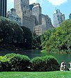
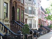
From top, left to right: Lower Manhattan skyline; Central Park; the Unisphere; the Brooklyn Bridge; Grand Central Terminal; the Statue of Liberty; the United Nations headquarters; and brownstones in Brooklyn | |||||
| |||||
| Nicknames: | |||||
 Interactive map of New York City | |||||
| Coordinates: 40°42′46″N 74°00′22″W / 40.71278°N 74.00611°Wनिर्देशांक: 40°42′46″N 74°00′22″W / 40.71278°N 74.00611°W[1] | |||||
| Country | |||||
| State | |||||
| Region | Mid-Atlantic | ||||
| Constituent counties (boroughs) | Bronx (The Bronx) Kings (Brooklyn) New York (Manhattan) Queens (Queens) Richmond (Staten Island) | ||||
| Historic colonies | New Netherland Province of New York | ||||
| Settled | 1624 (approx) | ||||
| Consolidated | 1898 | ||||
| Named for | James, Duke of York | ||||
| Government | |||||
| • Type | Strong mayor–council | ||||
| • Body | New York City Council | ||||
| • Mayor | Eric Adams (D) | ||||
| Area | |||||
| • Total | 472.43 बर्ग मील (1,223.59 किमी2) | ||||
| • Land | 300.46 बर्ग मील (778.19 किमी2) | ||||
| • Water | 171.97 बर्ग मील (445.40 किमी2) | ||||
| Elevation | 33 ft (10 m) | ||||
| Population | |||||
| • Total | 8,804,190 | ||||
| • Rank | 1st in the United States 1st in New York | ||||
| • Density | 29,302.37/बर्ग मील (11,313.68/किमी2) | ||||
| • Metro | 20,140,470 (1st) | ||||
| Demonym | New Yorker | ||||
| Time zone | UTC−05:00 (EST) | ||||
| • Summer (DST) | UTC−04:00 (EDT) | ||||
| ZIP Codes | 100xx–104xx, 11004–05, 111xx–114xx, 116xx | ||||
| Area codes | 212/646/332, 718/347/929, 917 | ||||
| FIPS code | 36-51000 | ||||
| GNIS feature ID | 975772 | ||||
| International airports | John F. Kennedy (JFK) LaGuardia (LGA) Newark Liberty (EWR) | ||||
| Rapid transit system | New York City Subway, Staten Island Railway, PATH | ||||
| GDP (City, 2019) | $884 billion[6] (1st) | ||||
| GMP (Metro, 2020) | $1.67 trillion[7] (1st) | ||||
| Largest borough by area | Queens (109 वर्ग मील या 280 वर्ग किलोमीटर) | ||||
| Largest borough by population | Brooklyn (2019 est. 2,559,903)[8] | ||||
| Largest borough by GDP (2019) | Manhattan ($635.3 billion)[6] | ||||
| Website | www | ||||
| ऑफिशियल नाँव | Statue of Liberty; The 20th-Century Architecture of Frank Lloyd Wright | ||||
| प्रकार | Cultural | ||||
| पैमाना | i, ii, vi | ||||
| तिथी | 1984, 2019 (8th, 43rd sessions) | ||||
| रिफरेंस नं॰ | [1]; [2] | ||||
| State Party | United States | ||||
| Region | Europe and North America | ||||
संदर्भ
संपादन करीं- ↑ "US Gazetteer files: 2010, 2000, and 1990". United States Census Bureau. February 12, 2011. Retrieved April 23, 2011.
- ↑ "2021 U.S. Gazetteer Files". United States Census Bureau. Retrieved September 5, 2021.
- ↑ "US Board on Geographic Names". United States Geological Survey. June 23, 2018. Retrieved January 31, 2008. Search for feature ID 975772.
- ↑ "QuickFacts: New York city, New York". U.S. Census Bureau. Retrieved August 17, 2021.
- ↑ "2020 Population and Housing State Data". United States Census Bureau. August 22, 2021. Retrieved November 24, 2021.
- ↑ 6.0 6.1 "Gross Domestic Product by County, 2019" (PDF). Bureau of Economic Analysis. December 9, 2020. Retrieved December 9, 2020.
- ↑ "U.S. metro areas—ranked by Gross Metropolitan Product (GMP) 2020 | Statistic". Statista. Retrieved May 31, 2019.
- ↑ "State & County QuickFacts—Kings County (Brooklyn Borough), New York". United States Census Bureau. Archived from the original on February 17, 2016. Retrieved May 16, 2020.
- ↑ "World Urban Areas" (PDF). Demographia. April 2018. Retrieved April 27, 2018.
- ↑ "10 Most Photographed Places in the World Will Surprise You". Travelzoo, Canadian Edition. May 24, 2018. Retrieved March 25, 2021.
- ↑ "NYC Mayor's Office for International Affairs". The City of New York. Archived from the original on June 16, 2015. Retrieved June 24, 2015.
- ↑ "DDC New York". Digital Diplomacy Coalition, New York. Archived from the original on July 27, 2018. Retrieved August 11, 2018.
Established in 2014, DDC New York has partnered with the United Nations, major tech and social media companies, multiple governments, and NGOs to bring unique programs to the area community.
| ई अमेरिका (यूएसए) के जगह संबंधी लेख एगो आधार बाटे। जानकारी जोड़ के एकरा के बढ़ावे में विकिपीडिया के मदद करीं। |


