मैकेंजी नदी
मैकेंजी नदी (अंग्रेजी: Mackenzie River) उत्तर अमेरिका महादीप के एक ठो प्रमुख नदी बाटे।
| Mackenzie River Le fleuve Mackenzie Deh-Cho Kuukpak | |
|---|---|
 The Mackenzie River in August 2009 | |
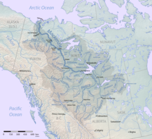
 Map of the Mackenzie River watershed | |
| नाँव | Alexander Mackenzie, explorer |
| लोकेशन | |
| Country | Canada |
| Region | Yukon Northwest Territories |
| Cities | Fort Providence, Fort Simpson, Wrigley, Tulita, Norman Wells, Fort Good Hope, Tsiigehtchic, Inuvik |
| भौतिक लच्छन सभ | |
| Source | Great Slave Lake |
| - location | Fort Providence |
| - coordinates | 61°12′15″N 117°22′31″W / 61.20417°N 117.37528°W |
| - elevation | 156 मी (512 फीट) |
| मुहाना | Arctic Ocean |
- location | Beaufort Sea, Inuvik Region |
- coordinates | 68°56′23″N 136°10′22″W / 68.93972°N 136.17278°Wनिर्देशांक: 68°56′23″N 136°10′22″W / 68.93972°N 136.17278°W |
- elevation | 0 मी (0 फीट) |
| लंबाई | 1,738 किमी (1,080 मील) |
| थाला के साइज | 1,805,200 किमी2 (1.9431×10¹³ वर्ग फु)[3] |
| Discharge | |
| - location | mouth; max and min at Arctic Red confluence[1] |
| - average | 9,910 m3/s (350,000 cu ft/s)[1] |
| - minimum | 2,180 m3/s (77,000 cu ft/s) |
| - maximum | 35,000 m3/s (1,200,000 cu ft/s)[2] |
| थाला लच्छन | |
| सहायिका | |
| - left | Liard River, Keele River, Arctic Red River, Peel River |
| - right | Great Bear River |
संदर्भ
संपादन करीं- ↑ 1.0 1.1 उद्धरण खराबी:Invalid
<ref>tag; no text was provided for refs namedwatershed - ↑ Daqing Yang, Xiaogang Shi, Philip Marsh (2015-09-04). "Variability and extreme of Mackenzie River daily discharge during 1973–2011". Quaternary International. ScienceDirect. 380–381: 159–168. doi:10.1016/j.quaint.2014.09.023. Retrieved 2017-10-28.
{{cite journal}}: CS1 maint: multiple names: authors list (link) - ↑ उद्धरण खराबी:Invalid
<ref>tag; no text was provided for refs namedriversofcanada
| ई लेख कौनो नदी के बारे में एगो आधार बाटे। जानकारी जोड़ के एकरा के बढ़ावे में विकिपीडिया के मदद करीं। |