यूनाइटेड किंगडम
एह लेख के अंग्रेजी से भोजपुरी में अनुवाद के जरूरत बाटे। ई लेख (या एकर कुछ हिस्सा) अंग्रेजी में लिखल बा। |
यूनाइटेड किंगडम ऑफ ग्रेट ब्रिटेन एंड नॉदर्न आयरलैंड[9] (United Kingdom of Great Britain and Northern Ireland), संछेप में यूनाइटेड किंगडम, जौना के आमतौर पर यूके या ब्रिटेन कहल जाला यूरोप के एगो संप्रभु राज्य बाटे। यूरोपीय मुख्य भूमि के उत्तर-पच्छिमी किनारे पर मौजूद यूनाइटेड किंगडम के अंतर्गत, ग्रेट ब्रिटेन (जवना के नाँव बोलचाल में अक्सरहा पुरा देस खातिर इस्तेमाल कइ दिहल जाला) आ आयरलैंड दीप के उत्तरी पूरबी भाग, अ अउरी बहुत सारा छोट-छोट दीप आवेलें।[10] उत्तरी आयरलैंड एक मात्र अइसन हिस्सा बाटे जवन कौनों दूसर राष्ट्र (आयरलैंड रिपब्लिक) के साथे जमीनी सीमा वाला बा।[नोट 6] एह जमीनी सीमा के छोड़ दिहल जाव तब यूके चारों ओर से अटलांटिक महासागर से घेराइल बाटे, जहाँ एकरे पूरुब ओर नॉर्थ सागर, दक्खिन में इंग्लिश चैनल आ दक्खिन-दक्खिन पच्छिम में सेल्टिक सागर बाड़ें। ग्रेट ब्रिटेन आ आयरलैंड के बीच के समुंद्र के आयरिश सागर कहल जाला। क्षेत्रफल में 93,800 वर्ग मील (243,000 किमी2) बिस्तार वाला यूनाइटेड किंगडम दुनिया के 78वाँ संप्रभु राज्य आ यूरोप में 11वाँ अस्थान पर बाटे। जनसंख्या के हिसाब से ई देस 21वाँ नम्बर के सभसे ढेर जनसंख्या वाला देस बाटे आ एकर जनसंख्या लगभग 65.1 मिलियन बाटे।[11] एही से ई यूरोपियन युनियन के चउथा सभसे घना आबादी वाला देस बाटे।[नोट 7][12]
यूनाइटेड किंगडम ऑफ ग्रेट ब्रिटेन एंड नॉर्दर्न आयरलैंड | |
|---|---|
राष्ट्रगान: "en:God Save the King"[नोट 2] | |
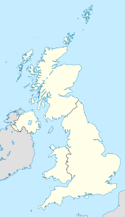
 the यूनाइटेड किंगडम के लोकेशन (गहिरा हरियर) – यूरोप (हरियर & गहिरा मटियाहूँ) में | |
| राजधानी आ सभसे बड़ शहर | लंदन |
| ऑफिशियल भासा आ राष्ट्रीय भासा सभ | अंग्रेजी |
| पहिचानल क्षेत्रीय भासा सभ[नोट 3] | |
| एथनिक ग्रुप (2011) | |
| लोग कहाला |
|
| सरकार | Unitary parliamentary en:constitutional monarchy |
• Monarch | en: Charles III |
| Rishi Sunak | |
| बिधायिका | Parliament |
• ऊपरी सदन | en:House of Lords |
• निचला सदन | House of Commons |
| Formation | |
| 1 मई 1707 | |
| 1 जनवरी 1801 | |
| 5 दिसंबर 1922 | |
| रकबा | |
• कुल | 242,495 किमी2 (93,628 वर्ग मील)[3] (78वाँ) |
• जल (%) | 1.34 |
| जनसंख्या | |
• 2016 अनुमान | 65,102,385[4] (22वाँ) |
• 2011 जनगणना | 63,181,775[5] (22वाँ) |
• Density | 255.6/किमी2 (662.0/वर्ग मील) (51वाँ) |
| जीडीपी (पीपीपी) | 2015 अनुमान |
• कुल | $2.679 trillion (9वाँ) |
• प्रति ब्यक्ति | $41,159[6] (25वाँ) |
| जीडीपी (नॉमिनल) | 2015 अनुमान |
• कुल | $2.849 trillion (5वाँ) |
• Per capita | $43,771[6] (13वाँ) |
| गिनी (2014) | medium · 33वाँ |
| एचडीआइ (2014) | very high · 14वाँ |
| करेंसी | पौंड स्टर्लिंग[नोट 4] (GBP; £) |
| टाइम जोन | GMT[नोट 5] (यूटीसी) |
• गर्मीं में (डीएसटी) | BST (यूटीसी+1) |
| तारीख प्रारूप | dd/mm/yyyy (AD) |
| ड्राइविंग | left |
| कालिंग कोड | +44 |
| इंटरनेट टीएलडी | .uk |
.svg)
.svg)
युनाइटेड किंगडम एगो en:constitutional monarchy (संबैधानिक राजतंत्र) हवे जहाँ संसदीय ब्यवस्था वाला शासन बाटे।[13][14] एकर राजधानी लंदन, एगो महत्वपूर्ण बैस्विक शहर आ फाइनेंस के केन्द्र बाटे जहाँ के शहरी आबादी 10,310,000 बा आ ई यूरोप के चउथा सभसे बड़ा शहर बाटे।[15] वर्तमान में एकर इहाँ के राजशाही के प्रमुख 6 फरवरी 1952 से महारानी एलिजाबेथ II बाड़ी। यूनाइटेड किंगडम में चार गो देस (country) आवे लें: इंग्लैंड, स्कॉटलैंड, वेल्स, आ उत्तरी आयरलैंड।[16] बाद के तीनों के प्रशासनिक स्वायत्तता दिहल गइल बाटे,[17] हालांकि, ई तीनों खातिर अलग-अलग किसिम के बाटे[18][19] आ इनहन के राजधानी, क्रम से एडिनबर्ग, कार्डिफ, आ बेलफास्ट बा। नगिचे के आइल्स ऑफ मैन, बालिविक ऑफ गुएर्नसी आ बालिविक ऑफ जर्सी युनाइटेड किंगडम के हिस्सा ना हवे बलुक, en:Crown dependencies हवें ब्रिटिश सरकार इनहन के सुरक्षा आ अंतर्राष्ट्रीय प्रतिनिधित्व करे ला।[20]
भूगोल
संपादन करीं
The total area of the United Kingdom is approximately 243,610 वर्ग किलोमीटर (94,060 वर्ग मील). The country occupies the major part of the British Isles[21] archipelago and includes the island of Great Britain, the north-eastern one-sixth of the island of Ireland and some smaller surrounding islands. It lies between the North Atlantic Ocean and the North Sea with the south-east coast coming within 22 मील (35 किमी) of the coast of northern France, from which it is separated by the English Channel.[22] In 1993 10 % of the UK was forested, 46 % used for pastures and 25 % cultivated for agriculture.[23] The Royal Greenwich Observatory in London is the defining point of the Prime Meridian.[24]
The United Kingdom lies between latitudes 49° to 61° N, and longitudes 9° W to 2° E. Northern Ireland shares a 224-मील (360 किमी) land boundary with the Republic of Ireland.[22] The coastline of Great Britain is 11,073 मील (17,820 किमी) long.[25] It is connected to continental Europe by the Channel Tunnel, which at 31 मील (50 किमी) (24 मील (38 किमी) underwater) is the longest underwater tunnel in the world.[26]
England accounts for just over half of the total area of the UK, covering 130,395 वर्ग किलोमीटर (50,350 वर्ग मील).[27] Most of the country consists of lowland terrain,[23] with mountainous terrain north-west of the Tees-Exe line; including the Cumbrian Mountains of the Lake District, the Pennines, Exmoor and Dartmoor. The main rivers and estuaries are the Thames, Severn and the Humber. England's highest mountain is Scafell Pike (978 मीटर (3,209 फीट)) in the Lake District. Its principal rivers are the Severn, Thames, Humber, Tees, Tyne, Tweed, Avon, Exe and Mersey.[23]


Scotland accounts for just under a third of the total area of the UK, covering 78,772 वर्ग किलोमीटर (30,410 वर्ग मील)[28] and including nearly eight hundred islands,[29] predominantly west and north of the mainland; notably the Hebrides, Orkney Islands and Shetland Islands. Scotland is the most mountainous country in the UK and its topography is distinguished by the Highland Boundary Fault—a geological rock fracture—which traverses Scotland from Arran in the west to Stonehaven in the east.[30] The fault separates two distinctively different regions; namely the Highlands to the north and west and the lowlands to the south and east. The more rugged Highland region contains the majority of Scotland's mountainous land, including Ben Nevis which at 1,343 मीटर (4,406 फीट) is the highest point in the British Isles.[31] Lowland areas—especially the narrow waist of land between the Firth of Clyde and the Firth of Forth known as the Central Belt—are flatter and home to most of the population including Glasgow, Scotland's largest city, and Edinburgh, its capital and political centre, although upland and mountainous terrain lies within the Southern Uplands.
Wales accounts for less than a tenth of the total area of the UK, covering 20,779 वर्ग किलोमीटर (8,020 वर्ग मील).[32] Wales is mostly mountainous, though South Wales is less mountainous than North and mid Wales. The main population and industrial areas are in South Wales, consisting of the coastal cities of Cardiff, Swansea and Newport, and the South Wales Valleys to their north. The highest mountains in Wales are in Snowdonia and include Snowdon (वेल्श: Yr Wyddfa) which, at 1,085 मीटर (3,560 फीट), is the highest peak in Wales.[23] The 14, or possibly 15, Welsh mountains over 3,000 फीट (910 मीटर) high are known collectively as the Welsh 3000s. Wales has over 2,704 किलोमीटर (1,680 मील) of coastline.[25] Several islands lie off the Welsh mainland, the largest of which is Anglesey (Ynys Môn) in the north-west.

Northern Ireland, separated from Great Britain by the Irish Sea and North Channel, has an area of 14,160 वर्ग किलोमीटर (5,470 वर्ग मील) and is mostly hilly. It includes Lough Neagh which, at 388 वर्ग किलोमीटर (150 वर्ग मील), is the largest lake in the British Isles by area.[33] The highest peak in Northern Ireland is Slieve Donard in the Mourne Mountains at 852 मीटर (2,795 फीट).[23]
Climate
संपादन करींThe United Kingdom has a temperate climate, with plentiful rainfall all year round.[22] The temperature varies with the seasons seldom dropping below −11 °C (12 °F) or rising above 35 °C (95 °F).[34] The prevailing wind is from the south-west and bears frequent spells of mild and wet weather from the Atlantic Ocean,[22] although the eastern parts are mostly sheltered from this wind since the majority of the rain falls over the western regions the eastern parts are therefore the driest. Atlantic currents, warmed by the Gulf Stream, bring mild winters;[35] especially in the west where winters are wet and even more so over high ground. Summers are warmest in the south-east of England, being closest to the European mainland, and coolest in the north. Heavy snowfall can occur in winter and early spring on high ground, and occasionally settles to great depth away from the hills.
Administrative divisions
संपादन करींThere is no consistent system of administrative or geographic demarcation across the United Kingdom.[36] Each country of the United Kingdom has its own arrangements, whose origins often pre-date the UK's formation. Until the 19th century there was little change to those arrangements, but there has since been a constant evolution of role and function,[37] most significantly the devolution of powers to Scotland, Wales and Northern Ireland.
The organisation of local government in England is complex, with the distribution of functions varying according to local arrangements. Legislation concerning local government in England is the responsibility of the UK's parliament and the government, as England has no devolved legislature. The upper-tier subdivisions of England are the nine regions, now used primarily for statistical purposes.[38] One region, Greater London, has had a directly elected assembly and mayor since 2000 following popular support for the proposal in a referendum.[39] It was intended that other regions would also be given their own elected regional assemblies, but a proposed assembly in the North East region was rejected by a referendum in 2004.[40] Below the regional tier, some parts of England have county councils and district councils and others have unitary authorities; while London consists of 32 London boroughs and the City of London. Councillors are elected by the first-past-the-post system in single-member wards or by the multi-member plurality system in multi-member wards.[41]
For local government purposes, Scotland is divided into 32 council areas, with wide variation in both size and population. The cities of Glasgow, Edinburgh, Aberdeen and Dundee are separate council areas, as is the Highland Council which includes a third of Scotland's area but only just over 200,000 people. Local councils are made up of elected councillors, of whom there are 1,223;[42] they are paid a part-time salary. Elections are conducted by single transferable vote in multi-member wards that elect either three or four councillors. Each council elects a Provost, or Convenor, to chair meetings of the council and to act as a figurehead for the area. Councillors are subject to a code of conduct enforced by the Standards Commission for Scotland.[43] The representative association of Scotland's local authorities is the Convention of Scottish Local Authorities (COSLA).[44]
Local government in Wales consists of 22 unitary authorities. These include the cities of Cardiff, Swansea and Newport which are unitary authorities in their own right.[45] Elections are held every four years under the first-past-the-post system.[45] The most recent elections were held in May 2012, except for the Isle of Anglesey. The Welsh Local Government Association represents the interests of local authorities in Wales.[46]
Local government in Northern Ireland has since 1973 been organised into 26 district councils, each elected by single transferable vote. Their powers are limited to services such as collecting waste, controlling dogs and maintaining parks and cemeteries.[47] On 13 मार्च 2008 the executive agreed on proposals to create 11 new councils and replace the present system.[48] The next local elections were postponed until 2016 to facilitate this.[49]
नोट
संपादन करीं- ↑ स्कॉटलैंड में एगो दूसर राजशाही चीन्हा प्रयोग होला: [देखे खातिर क्लिक करीं].
- ↑ There is no authorised version of the national anthem as the words are a matter of tradition; only the first verse is usually sung.[1] No law was passed making "God Save the Queen" the official anthem. In the English tradition, such laws are not necessary; proclamation and usage are sufficient to make it the national anthem. "God Save the Queen" also serves as the Royal anthem for certain en:Commonwealth realms.
- ↑ Under the Council of Europe's European Charter for Regional or Minority Languages, Scots, Ulster Scots, Welsh, Cornish, Scottish Gaelic and Irish are officially recognised as regional or minority languages by the British government for the purposes of the Charter.[2] ईहो देखल जाय en:Languages of the United Kingdom.
- ↑ कुछ अइसन देस जवन कुछ हद तक खुदशासित बाड़ें, राजशाही के निर्भर राज्यक्षेत्र बाड़ें आ कुछ समुन्दर पर ब्रिटिश क्षेत्र आपन खुद के पौंड करेंसी छापे लें, या फिर दुसरे देस के करेंसी इस्तमाल करे लें, ढेर जानकारी खातिर अंग्रेजी में देखल जाय en:List of British currencies।
- ↑ यूके के कुछ निर्भर राज्यक्षेत्र एह टाइम जोन से बाहर बाड़ें। अंग्रेजी में देखल जाय en:Time in the United Kingdom#British territories।
- ↑ Although Northern Ireland is the only part of the UK that shares a land border with another state, two of its Overseas Territories also share land borders with other states. Gibraltar shares a border with Spain, while the Sovereign Base Areas of Akrotiri and Dhekelia share borders with the Republic of Cyprus, Turkish Republic of Northern Cyprus and UN buffer zone separating the two Cypriot polities.
- ↑ Following the referendum of 23 जून 2016, the UK will withdraw from the EU at a date to be determined.
![[देखे खातिर क्लिक करीं]](/wiki/%E0%A4%9A%E0%A4%BF%E0%A4%A4%E0%A5%8D%E0%A4%B0:Royal_Coat_of_Arms_of_the_United_Kingdom_(Scotland).svg)
संदर्भ
संपादन करीं- ↑ "National Anthem". Official web site of the British Royal Family. Retrieved 4 जून 2016.
- ↑ "List of declarations made with respect to treaty No. 148". en:Council of Europe. Archived from the original on 2013-12-12. Retrieved 12 दिसंबर 2013.
- ↑ "Demographic Yearbook – Table 3: Population by sex, rate of population increase, surface area and density" (PDF). United Nations Statistics Division. 2012. Retrieved 9 अगस्त 2015.
{{cite journal}}: Cite journal requires|journal=(help) - ↑ "U.K. Population (2016) - Worldometers". worldometers.info.
- ↑ "2011 UK censuses". Office for National Statistics. Retrieved 17 दिसंबर 2012.
- ↑ 6.0 6.1 "Report for Selected Countries and Subjects". वल्ड इकोनामिक आउटलुक डेटाबेस. अंतर्राष्ट्रीय मुद्रा कोष. 2016. Retrieved 15 अप्रैल 2016.
- ↑ "Gini coefficient of equivalised disposable income (source: SILC)". Eurostat Data Explorer. Retrieved 11 November 2015.
- ↑ "2015 Human Development Report" (PDF). 14 दिसंबर 2015. Retrieved 14 दिसंबर 2015.
- ↑ http://www.dw.com/hi/%E0%A4%AF%E0%A5%82%E0%A4%95%E0%A5%87-%E0%A4%9C%E0%A5%80%E0%A4%AC%E0%A5%80-%E0%A4%AC%E0%A5%8D%E0%A4%B0%E0%A4%BF%E0%A4%9F%E0%A5%87%E0%A4%A8-%E0%A4%94%E0%A4%B0-%E0%A4%87%E0%A4%82%E0%A4%97%E0%A5%8D%E0%A4%B2%E0%A5%88%E0%A4%82%E0%A4%A1-%E0%A4%AE%E0%A5%87%E0%A4%82-%E0%A4%AB%E0%A4%B0%E0%A5%8D%E0%A4%95/g-19338153
- ↑ "Definition of Great Britain in English". Oxford University Press. Archived from the original on 2013-10-04. Retrieved 29 अक्टूबर 2014.
Great Britain is the name for the island that comprises England, Scotland, and Wales, although the term is also used loosely to refer to the United Kingdom.
- ↑ "United Kingdom". International Monetary Fund. Retrieved 1 अप्रैल 2016.
- ↑ "UK Perspectives 2016: The UK in a European context". Office for National Statistics. 26 मई 2016. Retrieved 16 जून 2016.
- ↑ The British Monarchy, What is constitutional monarchy?. Retrieved 17 July 2013
- ↑ CIA, The World Factbook Archived 2021-01-02 at the Wayback Machine. Retrieved 17 July 2013
- ↑ The 30 Largest Urban Agglomerations Ranked by Population Size at Each Point in Time, 1950-2030, World Urbanization Prospects, the 2014 revision, Population Division of the United Nations Department of Economic and Social Affairs. Retrieved 22 फरवरी 2015.
- ↑ "Countries within a country". Prime Minister's Office. 10 जनवरी 2003. Retrieved 8 मार्च 2015.
- ↑ "Devolution of powers to Scotland, Wales, and Northern Ireland". United Kingdom Government. Retrieved 17 अप्रैल 2013.
In a similar way to how the government is formed from members from the two Houses of Parliament, members of the devolved legislatures nominate ministers from among themselves to comprise an executive, known as the devolved administrations...
- ↑ "Fall in UK university students". BBC News. 29 जनवरी 2009.
- ↑ "Country Overviews: United Kingdom". Transport Research Knowledge Centre. Archived from the original on 2010-04-04. Retrieved 28 मार्च 2010.
- ↑ "Key facts about the United Kingdom". Directgov. Archived from the original on 3 अक्टूबर 2012. Retrieved 6 मार्च 2015.
The full title of this country is 'the United Kingdom of Great Britain and Northern Ireland'. Great Britain is made up of England, Scotland and Wales. The United Kingdom (UK) is made up of England, Scotland, Wales and Northern Ireland. 'Britain' is used informally, usually meaning the United Kingdom.
The Channel Islands and the Isle of Man are not part of the UK. - ↑ Oxford English Dictionary: "British Isles: a geographical term for the islands comprising Great Britain and Ireland with all their offshore islands including the Isle of Man and the Channel Islands."
- ↑ 22.0 22.1 22.2 22.3 "United Kingdom". The World Factbook. Central Intelligence Agency. Archived from the original on 2 January 2021. Retrieved 23 September 2008.
- ↑ 23.0 23.1 23.2 23.3 23.4 Latimer Clarke Corporation Pty Ltd. "United Kingdom – Atlapedia Online". Atlapedia.com. Retrieved 26 अक्टूबर 2010.
- ↑ ROG Learning Team (23 अगस्त 2002). "The Prime Meridian at Greenwich". Royal Museums Greenwich. Royal Museums Greenwich. Retrieved 11 September 2012.
- ↑ 25.0 25.1 Darkes, Giles (जनवरी 2008). "How long is the UK coastline?". The British Cartographic Society. Archived from the original on 22 May 2012. Retrieved 24 January 2015.
- ↑ "The Channel Tunnel". Eurotunnel. Archived from the original on 18 December 2010. Retrieved 8 मार्च 2015.
- ↑ "England – Profile". BBC News. 11 February 2010.
- ↑ "Scotland Facts". Scotland Online Gateway. Archived from the original on 21 जून 2008. Retrieved 16 July 2008.
- ↑ Winter, Jon (1 जून 2000). "The complete guide to the ... Scottish Islands". The Independent. London. Retrieved 8 मार्च 2015.
- ↑ "Overview of Highland Boundary Fault". Gazetteer for Scotland. University of Edinburgh. Retrieved 27 December 2010.
- ↑ "Ben Nevis Weather". Ben Nevis Weather. Archived from the original on 2018-09-24. Retrieved 26 अक्टूबर 2008.
- ↑ "Profile: Wales". BBC News. 9 जून 2010. Retrieved 7 November 2010.
- ↑ "Geography of Northern Ireland". University of Ulster. Archived from the original on 18 January 2012. Retrieved 22 May 2006.
- ↑ "UK climate summaries". Met Office. Retrieved 1 May 2011.
- ↑ "Atlantic Ocean Circulation (Gulf Stream)". UK Climate Projections. Met Office. Archived from the original on 2018-10-17. Retrieved 8 मार्च 2015.
- ↑ United Nations Economic and Social Council (अगस्त 2007). "Ninth UN Conference on the standardization of Geographical Names" (PDF). UN Statistics Division. Archived from the original (PDF) on 1 December 2009. Retrieved 21 अक्टूबर 2008.
- ↑ Barlow, I.M. (1991). Metropolitan Government. London: Routledge. ISBN 978-0-415-02099-2.
- ↑ "Welcome to the national site of the Government Office Network". Government Offices. Archived from the original on 15 जून 2009. Retrieved 3 July 2008.
- ↑ "A short history of London government". Greater London Authority. Archived from the original on 21 April 2008. Retrieved 4 अक्टूबर 2008.
- ↑ Sherman, Jill; Norfolk, Andrew (5 November 2004). "Prescott's dream in tatters as North East rejects assembly". The Times. London. Archived from the original on 25 May 2010. Retrieved 15 February 2008.
The Government is now expected to tear up its twelve-year-old plan to create eight or nine regional assemblies in England to mirror devolution in Scotland and Wales.
(subscription required) - ↑ "Local Authority Elections". Local Government Association. Archived from the original on 18 January 2012. Retrieved 8 मार्च 2015.
- ↑ "STV in Scotland: Local Government Elections 2007" (PDF). Political Studies Association. Archived from the original (PDF) on 20 मार्च 2011. Retrieved 2 अगस्त 2008.
- ↑ "The Councillors' Code of Conduct: 3rd Edition – December 2010". The Scottish Government. Retrieved 9 मार्च 2015.
- ↑ "Who we are". Convention of Scottish Local Authorities. Archived from the original on 21 May 2011. Retrieved 5 July 2011.
- ↑ 45.0 45.1 "Unitary authorities". Welsh Government. 2014. Archived from the original on 2015-03-10. Retrieved 9 मार्च 2015.
- ↑ "Welsh Local Government Association". Welsh Local Government Association. Retrieved 20 मार्च 2008.
- ↑ Devenport, Mark (18 November 2005). "NI local government set for shake-up". BBC News. Retrieved 15 November 2008.
- ↑ "Foster announces the future shape of local government" (Press release). Northern Ireland Executive. 13 मार्च 2008. Archived from the original on 25 July 2008. Retrieved 20 अक्टूबर 2008.
- ↑ "Local Government elections to be aligned with review of public administration" (Press release). Northern Ireland Office. 25 April 2008. Archived from the original on 17 February 2013. Retrieved 8 मार्च 2015.